Posted by
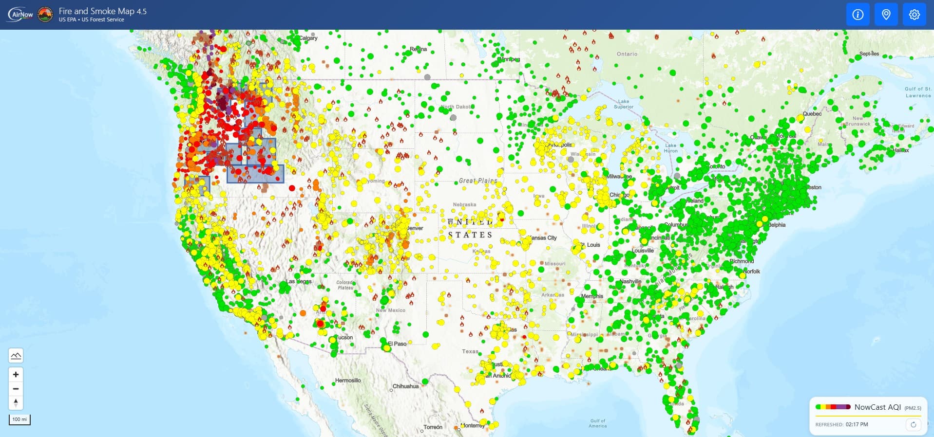
Explore a real-time map of fine particle pollution from wildfires and other sources provided by the US Forest Service, which includes overlays for topography, street views, and satellite imagery.
Similar Posts
Here’s what we found related to above. Click through to dive even deeper.

















You've reached the end.